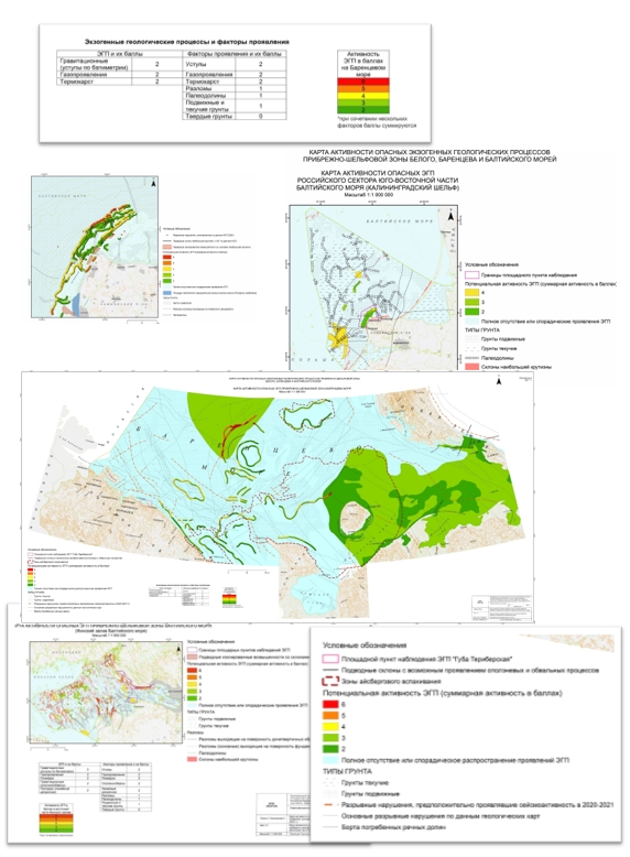
The necessity and urgency of governmental monitoring of the subsurface in the onshore and offshore zones of the seas in the North-West of the Russian Federation in order to assess the current state of exogenous geological processes and predict their changes is caused by the very high level of development of these zones. First of all, dredging of existing ports and ports under construction, as well as fairways – approaches to these ports.
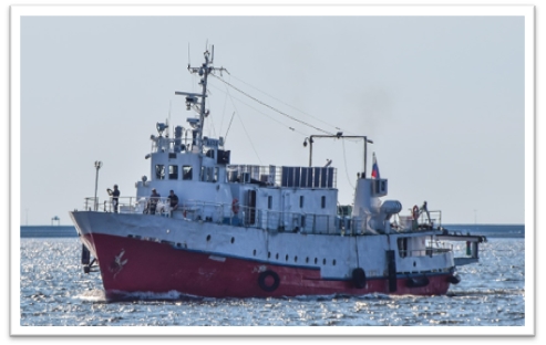
RV Maria
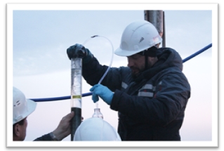
Bottom water sampling to measure gas concentrations
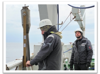
Soil sampling with a sealed piston sampler for geochemical analysis
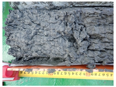
Splinter fracture of gas-saturated soil core
As a consequence and the opposite process, especially in the Baltic Sea and partly in the White Sea, the dredged material is dumped on the seabed and forms underwater ridges that are usually easily destroyed by currents.
This activity, together with the construction of various types of hydraulic engineering structures in the coastal zone (port terminals and berths, coastal protection structures, reclaimed artificial islands, all types of dams, viaducts, timber-crib dams, etc.), fundamentally alters or even destroys natural litho- and morphodynamic processes, transforming the bottom relief, changing the direction and volume of sediment flows and the distribution of bottom sediments, i.e. has a local but significant impact on the geological environment.
In the eastern Gulf of Finland and in the Russian part of the south-eastern Baltic Sea, usually outside the coastal zone, underwater mining (construction sands, ferromanganese nodules, amber) also causes dramatic changes in the seabed topography.
Expansion of oil production in the onshore-offshore zone adjacent to the Kaliningrad Region may potentially cause seismic events, which in turn may trigger the activation of exogenous geological processes.
Areal character of violations of the seabed surface and the near-surface geological section occurs within anchorages, which is clearly visible on side-scan sonar records, and in bottom trawling areas.
Various types of submarine transmission lines, particularly communication and power cables, are most susceptible to adverse effects of exogenous geological processes. When submarine pipelines are destroyed, environmental damage is added to the material loss.
Gravity-type exogenous geological processes are quite common in onshore-offshore zones of the Baltic, White and Barents Seas. These are underwater landslides, rockfall processes, etc.
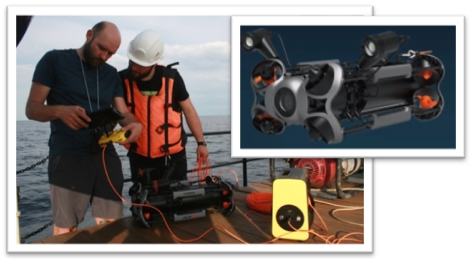
Underwater video recording of the seabed surface
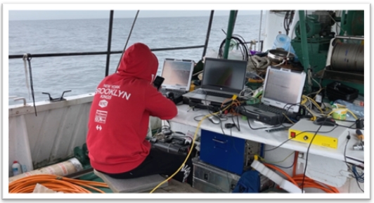
Performance of geophysical profiling complex

Gas-saturated soils on profiles of continuous seismoacoustic profiling
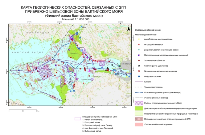
The result of the work is a map of geological hazards in the Gulf of Finland
Activation of gravity processes can be caused by various processes, both natural, in particular abrasion and seismic activity, and anthropogenic. At present, we can say with confidence that complex technogenesis, although local, has become comparable to natural processes in terms of intensity and frequency of impact as a trigger for the activation of exogenous geological processes.
Underwater gas-fluid discharge processes are characterised by significant activity, especially in the onshore-offshore zones of the Baltic Sea. Areas of gas-saturated sediments are particularly widespread, and linear subsidence in the Gulf of Finland in the form of gentle underwater troughs is also associated with them. Isotope analyses have shown that the gas (mainly methane) is of biogenic origin, i.e. it is mainly formed in recent bottom sediments due to organic matter reworking. As a result of global warming, the amount of methane and its homologues in bottom sediments is expected to increase, as is the area of gas-saturated soils. They have been identified in several areas of the Gulf of Finland and on the slopes of the Gdansk Depression in the south-eastern Baltic Sea.
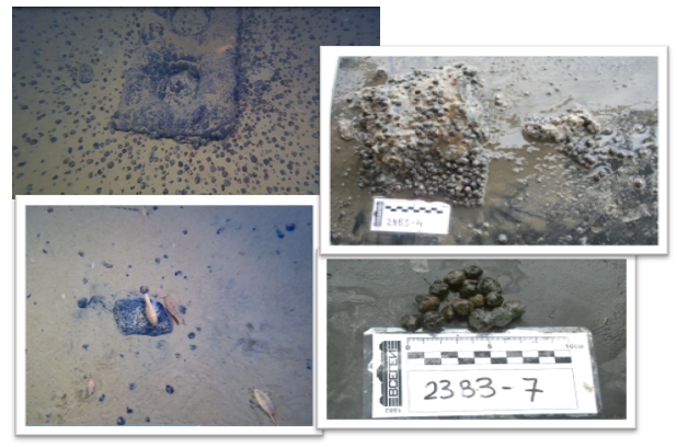
Iron-manganese nodules in the Gulf of Finland
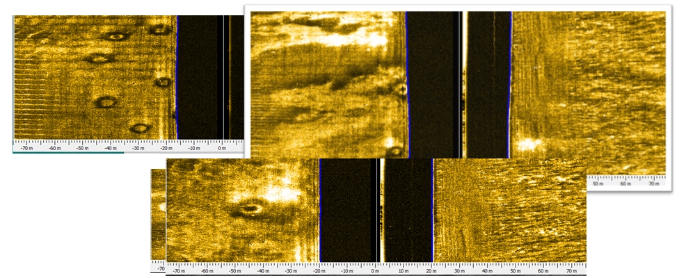
Pockmarks
The distribution of pockmarks associated with gas seeps has been identified on the Barents Sea shelf. Submarine groundwater outflows have been identified in Onega Bay in the White Sea, in the coastal zone of the Sambia Peninsula and the Curonian Spit in the southeastern Baltic Sea, and in Kopor’ye Bay in the Gulf of Finland. In the Baltic Sea, in the areas adjacent to the Curonian Spit, manifestations of clay diapirism have been identified: recent - in the Curonian Bay and relict - on the open sea side.
Monitoring of offshore exogenous geological processes is rather specific due to the impossibility of operational visual observation of their particular manifestations. The use of multibeam echosounding allows to partially solve this problem by obtaining quantitative indicators of underwater displacements of rock and sediment masses using high-resolution geodetic surveys in the mode of monitoring the seabed areas where certain manifestations of gravitational exogenous geological processes have been identified. However, the extremely high cost of such work means that it can only be carried out on a very limited area.
Nevertheless, long-term experience of work at observation sites in the White Sea, the Barents Sea and the Baltic Sea shows that traditional methods of marine geology can be used in the geological survey of the shelf: side-scan sonar and continuous seismoacoustic profiling, the results of which are confirmed and interpreted using seabed sampling and underwater phototeleprofiling, allow for a qualitative and, in some areas, quantitative assessment of the direction and intensity of gravity processes, as well as trends in the development of gas-fluid discharges. This, in turn, makes it possible to predict, on the basis of expert assessments, future changes in the geological environment depending on various scenarios of natural and anthropogenic process development, as well as to qualitatively assess the risk of certain exogenous geological processes.
