+7 (812) 328 9282 - Office, +7 (812) 328 9248 - Museum info@karpinskyinstitute.ru
Russian Geological Research Institute

The Kamchatka Party of the Karpinsky Institute finished the field season, having fully completed all work on the Kamchatka Peninsula within the Central Kamchatka Depression (CKD).
The research was a part of field work to further study the regional features of the geological structure and obtain new data in the field of stratigraphy, petrology, tectonics, isotope geochronology, and metallogeny (minerals distribution patterns) by groups of sheets of the State Geological Map-1000/3 within the Koryak-Kuril sheet series.
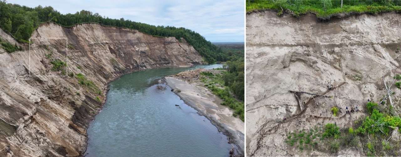
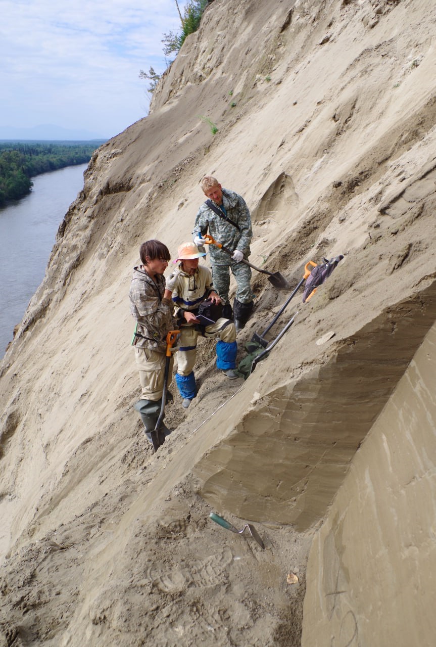
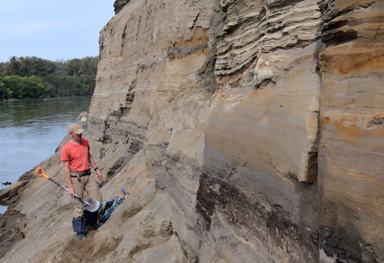
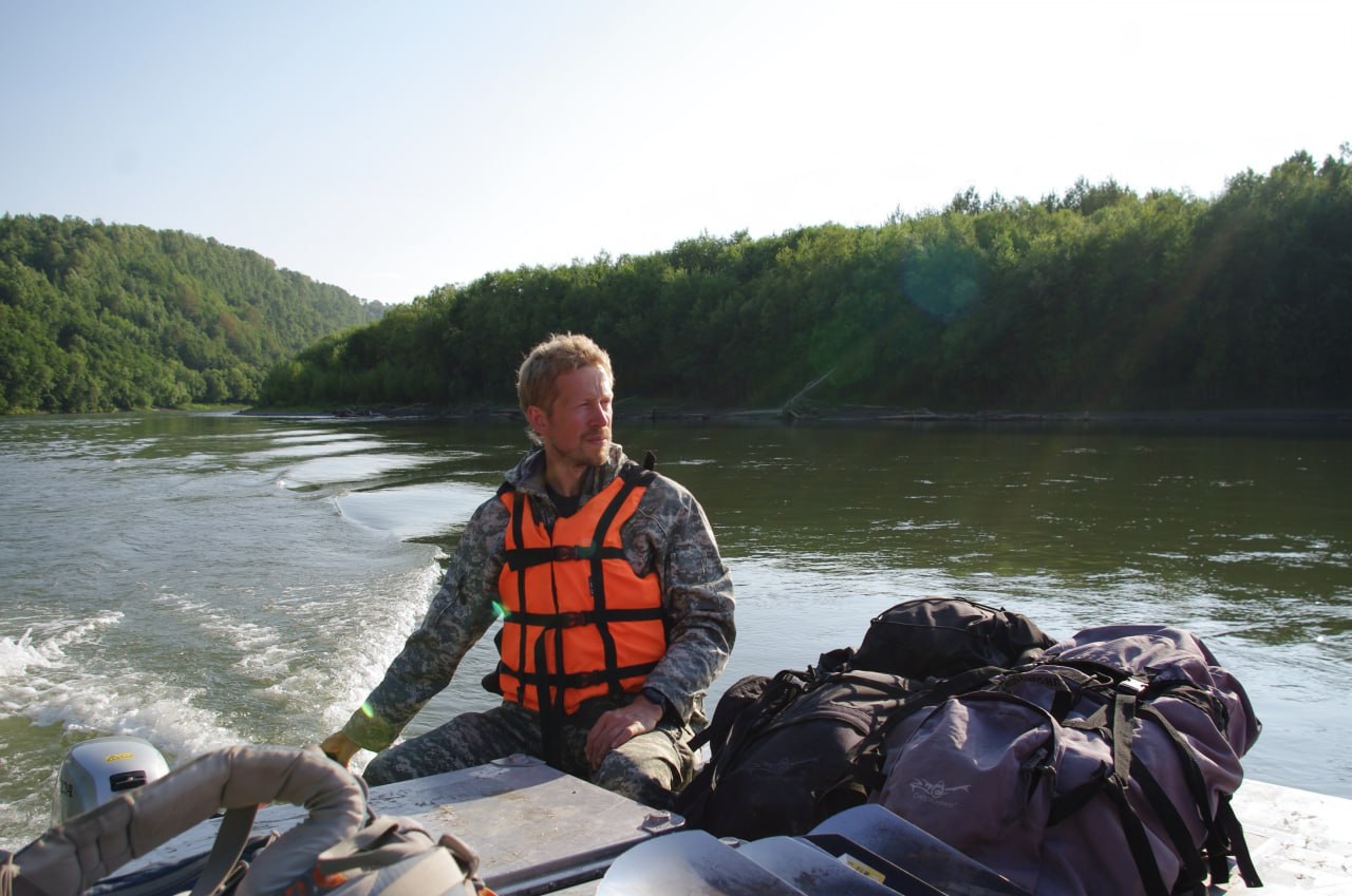
Over the course of a month, eight employees of the Kamchatka Party, under the leadership of the Head of the Party, Igor Zhigmanovsky, conducted work at two reference sites – the Generalskoye Rise and Peschany Island – located in the middle reaches of the Kamchatka River, in the southern and central parts of the Central Kamchatka Depression.
The sections were studied on foot in one-day routes. Travel within and between work sites was fulfilled by rafting down the Kamchatka River on an inflatable trimaran-type vessel.
The purpose of the study was to obtain new and revise existing data on the stratigraphic position and genesis of the main units in the visible part of the Quaternary section of the CKD, including clarification of the composition, structural and textural features, the nature of contacts, and the distribution boundaries of certain deposits.
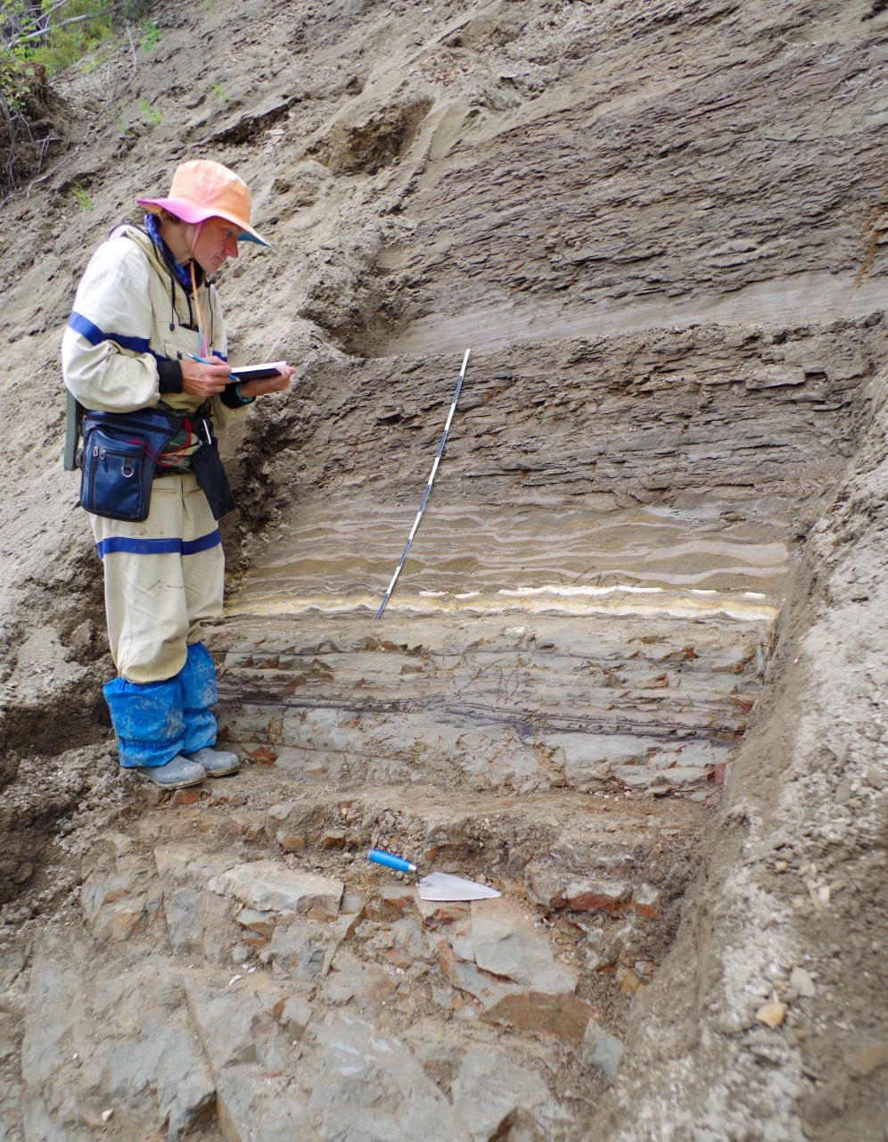
The issues were solved using modern sedimentological and geochronometric methods. The work included specialized geological studies on reference sections of the Quaternary formations and layer-by-layer sampling for various types of analysis.
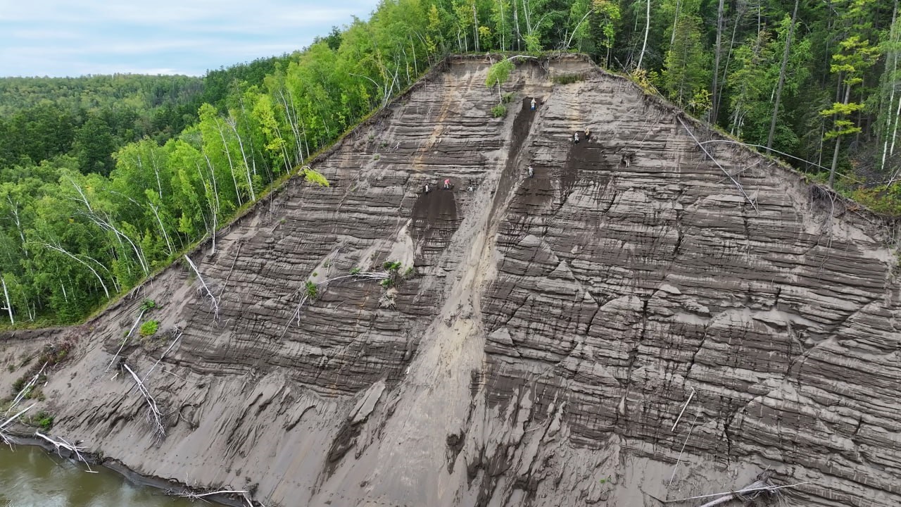
As a result of field work, 14 reference sections of the CKD, located in natural coastal outcrops along the Kamchatka River, were studied. Within the outcrops, 1242,4 m of wide artificial clearings were completed, where specialized geological studies of the Quaternary formations were conducted.
66 samples for age determination of rocks using the OSL method, 2 samples for age determination using the radiocarbon method, 88 samples for determination of micropaleontological remains (spore-pollen and diatom analyses), 62 sample for geochemical analysis of volcanic ash (microprobe + LA-ICP-MS), 18 samples for determining the granulometric composition of formations were taken.
The data obtained made it possible to clarify the structure in the visible part of the CKD Quaternary section with a total thickness of about 100 m represented by lacustrine, alluvial, glacial, lacustrine-glacial, glaciofluvial, and aeolian formations ranging in age from the Middle Neopleistocene to the Holocene.
The material collected during field work will allow in the future:
- to clarify the age of the main units in the visible part of the Quaternary section and to reconstruct the sedimentation environment of the CKD Quaternary rocks.
- to highlight new local units – stratogens, with their inclusion in the legend of the Koryak-Kuril series.
- to create a basis for the development of a modern stratigraphic chart for the dissection and interregional correlation of the Quaternary formations on a tephrochronological basis with determining the age of tephra in continental sedimentary sections using OSL dating.
The results of office processing of field work materials and laboratory analytical studies will be displayed in map sets and in the texts of explanatory notes.
|

|
|
|
|

|
|
|

|

