+7 (812) 328 9282 - Office, +7 (812) 328 9248 - Museum info@karpinskyinstitute.ru
Russian Geological Research Institute

During the meetings materials on 8 objects of the State Assignment of the Federal Agency for Mineral Management were heard and considered. In addition to the employees of the Karpinsky Institute and the contractor organization, the Academic Council was attended by representatives of Rosnedra and FGBU Rosgeolfund.
The work was carried out by structural subdivisions of the Karpinsky Institute with the involvement of one contractor organization Voronezh State University.
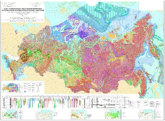
As a result of the work, 4 base maps of the Russian Federation and adjacent water areas at a scale of 1:2 500 000 and their thematic layers were updated. The team of authors presented the following maps:
Special mention should be made of the results of the facility for isotope-geochemical and geochronological support of Gosgeolmap-1000 monitoring and summary and overview mapping on the territory of the Russian Federation completed in 2024. As part of the work, a huge array of data on isotope-geochemical and geochronological study of magmatic and metamorphic complexes was obtained and structured. More than 250 reference objects were studied, 500 passports of geological objects with the results of isotope-geochemical, geochronological and petrological study of magmatic and metamorphic complexes were compiled.
The methods of assessing the prospects of ore-bearing intrusive complexes for gold-copper-porphyry mineralization and dating of zircons from different-age diamond placers were successfully tested, with the help of which recommendations were given for setting up GSR-200. As a result, lists and cartograms of the location of the studied granitoid complexes, classified into potentially ore-bearing for gold-copper-copper porphyry mineralization and ‘ore-free’, as well as areas promising for bed-rock diamond content, were prepared.
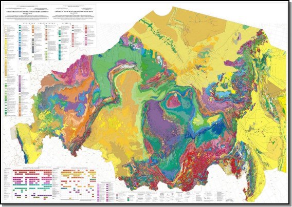
Within the framework of small-scale mapping, the preparation for publication of sets of the State Geological Map at a scale of 1:1 000 000 of the third generation on 3 sheets was completed, and author's versions of maps on 4 sheets were updated. Various stages of Gosgeolmap-1000 monitoring were carried out on 126 sheets, of which 53 sheets are being uploaded to UGCM (Unified Geological and Cartographic Model).